Map Projections
Objectives:
Learn about geographic coordinate systems and projections, their limitations, and how to apply
them in ArcGIS. Create simple map layouts.
Learn about geographic coordinate systems and projections, their limitations, and how to apply
them in ArcGIS. Create simple map layouts.
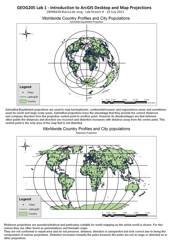
Figure 1
|
Choosing ProjectionsI understand that projections are used to transfer the spherical Earth onto a 2D surface and that it is important to choose a projections that best depict the data being displayed. Different projections have the ability to create less distortion in some areas, thus time should be spent analysing what display features are of most importance.
Editing in Layout ViewThe final map layout has been constructed in layout view. Using the resize, distribute and align tools to ensure that each feature is the same size, positioned correctly and distributed evenly across the page.
Cartographic ElementsI am able to add cartographic elements such as title, legend, scale and north arrow, choosing styles to fit and suit the maps.
|
