Aerial photos, editing and digitizing
Objectives:
Use aerial photographs as a source of digital data for GIS. Tasks include:
Use aerial photographs as a source of digital data for GIS. Tasks include:
- georeferencing an aerial photograph from ‘image space’ (e.g. as captured by a camera or scanner) to
- ‘real world space’ (e.g. a geographic or projected coordinate system)
- consideration of image resolution and distortion
- on-screen digitising of vector features and sources of error
- addition of feature attributes
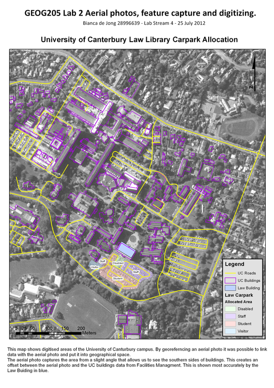
Figure 1
Georeferencing- Use of a map of NZ projected in the NZ Transverse Mercator coordinate system, to georeference an image by adding control points on identifiable features in both the image and the georeferenced data.
Editing Tool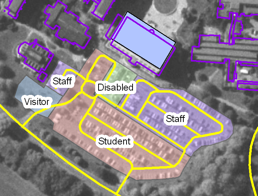 Figure 2
- Cut large polygons into smaller areas and add additional polygons using a common boundary of the original polygon (fig 2).
- Add attribute information to each feature to differentiate them. Once they hold attributes symbolise and label each feature using editing tools such as transparency, halos and colour differentiation. |
Digitizing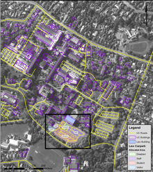 Figure 3
- Digitise elements from the raster image into vector format in the form of polygons (fig. 3)
- Select different colours and line thicknesses for the lines and polygons to differentiate them and to portray information effectively. |
