3D Analysis
Objectives:
To investigate the visual impact that a proposed subdivision would have on current residents on the Port Hills, Christchurch.
To investigate the visual impact that a proposed subdivision would have on current residents on the Port Hills, Christchurch.
ArcScene - Viewshed Analysis and Visualisiation
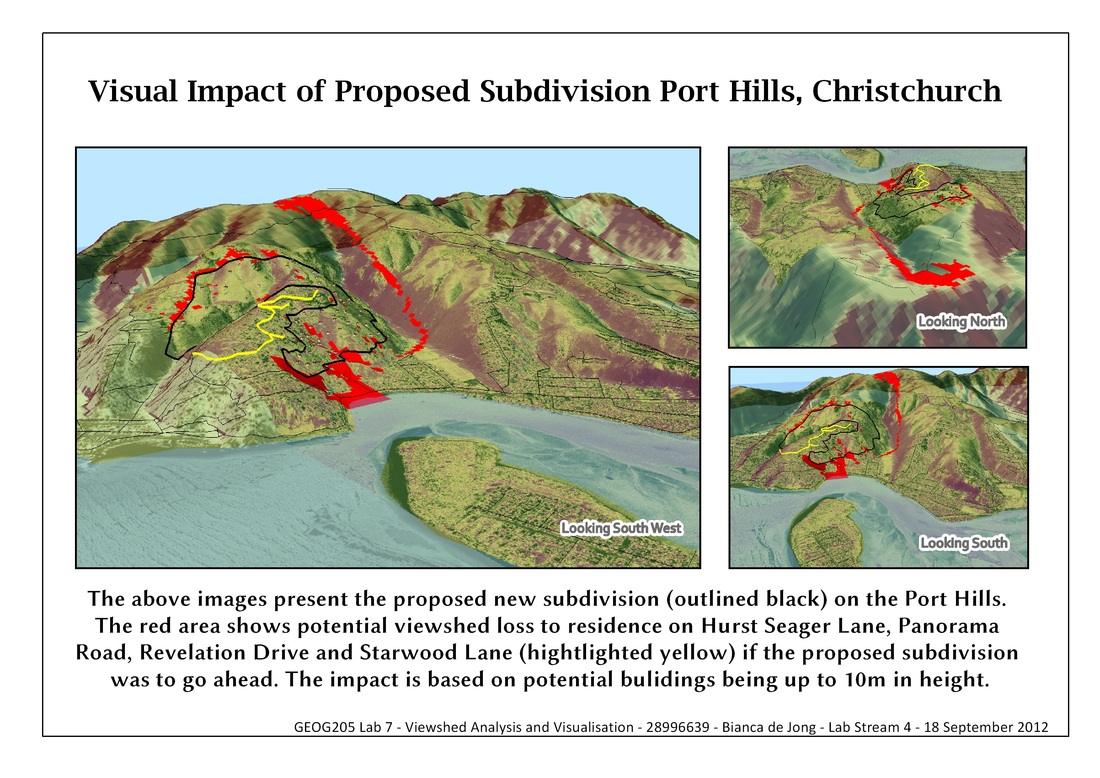
Figure 1
Using a terrain model I am able to create a viewshed analysis that identifies areas of terrain that can be seen from particular points on the terrain surface (Fig. 2) (Heywood, et al., 2006). Above I have created two digital elevation models (DEM) with a before and after viewshed in order to identify the viewshed lost.
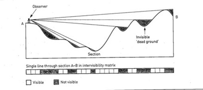
Figure 2. Ray tracing for visibility analysis (Heywood, et al., 2006)
Viewshed analysis can be used for a number of applications. Heywood et al. (2006) give examples of locating areas for radio transmission and cellphone towers to analyse maximum coverage and minimisation of commercial forestry impacts on protected areas. In lectures an example of use was to calculate visualisation from CCTV cameras, to identify areas where coverage was lost.
3D Effects
Using different stylizing effects I am able to create a 3D terrain model that depicts a realistic and accurate landscape.
Effects used:
Using different stylizing effects I am able to create a 3D terrain model that depicts a realistic and accurate landscape.
Effects used:
- Hillshade
- Draping of aerial photo over DEM
- Transparency of sea and hillshade
- Colour ramp
- Background colour to depict blue sky
- Illumination sun angle to give the effect of sunlight hitting the 3D model
- 3D building symbols, rotated to face north
- "Cookie cutter" in ArcMap, to create a polygon of the sea so that it could be coloured blue
Depicting 3D terrain models in a 2D image has its limitations. It is not possible to add a north arrow and scale, instead labels have to be used to inform view direction.
Flyover Animation
Using the animation toolbar I am able to take a series of snapshots from different angles around the 3D terrain model, and produce 10 second animation. This flyover animation gives a detailed 360 deg view of the terrain and viewshed lost from every angle.
