GPS to GIS
Objectives:
- Use a handheld GPS for navigation, and the collection of line data features
- Transfer of data for post processing and export to ArcGIS.
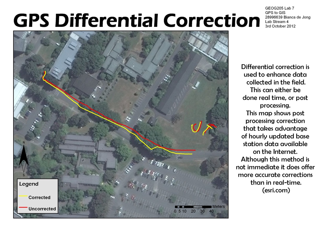
Figure 1
Data Collection
I am able to use a handheld Trimble Juno SB GPS and Terrasync software to:
The red features in figure 1 represent data collected in the field
- navigate to predetermined locations,
- create new data files
- collect features
The red features in figure 1 represent data collected in the field
Post Processing (data transfer, differential correction, and data export)
Using PathFinder Office, I am able to transfer data from the Trimble to a PC and use the differential correction wizard to correlate the data with more accurate base data via the internet. I am also able to export both the original and corrected data to ArcGIS. This data can be georeferenced and used to produce a map. In figure 1 I have georeferenced using Bing Maps via the internet.
The origin data collected was fairly accurate, it appears to out by approximately 1m to the NE and has a smoother line along the path. This slight "inaccuracy" is most likely due to the line the GPS operator was taking.
I experienced issues when it came to sending data for correction. One draw back was the need to wait for nearly an hour for the base to update, the second issue was an inability to process the data, most likely due to large demand from my colleagues also trying to send data.
